Algonquin-Cary Subarea Plan
Consultation has concluded

Update
The Algonquin-Cary Subarea Plan was completed in May 2021. The final plan is available for download here and on the right hand side of your screen.
Welcome to our virtual open house!
The Villages of Algonquin and Cary have partnered with the Chicago Metropolitan Agency for Planning (CMAP) to develop the Algonquin-Cary Subarea Plan, which presents a vision for the future of the Route 31 corridor.
We seek your feedback on the draft plan for this area. CMAP will use your input to revise the plan before submitting the final version to the Algonquin and Cary village boards for their consideration.
This open house event is virtual in compliance with the State of Illinois' Executive Orders regarding COVID-19 and public health guidance.
CLOSED: This virtual open house accepted public comments from January 27, 2021 to February 28, 2021. Read a summary of the results here (link). Thanks so much to everyone who contributed!
How to Participate
The virtual open house has five "stations" with information about the draft plan. Each station has a short video, a text summary, and a discussion forum.
- Introduction - Overview of the planning area and process.
- Vision and Design Principles to help guide future decision-making.
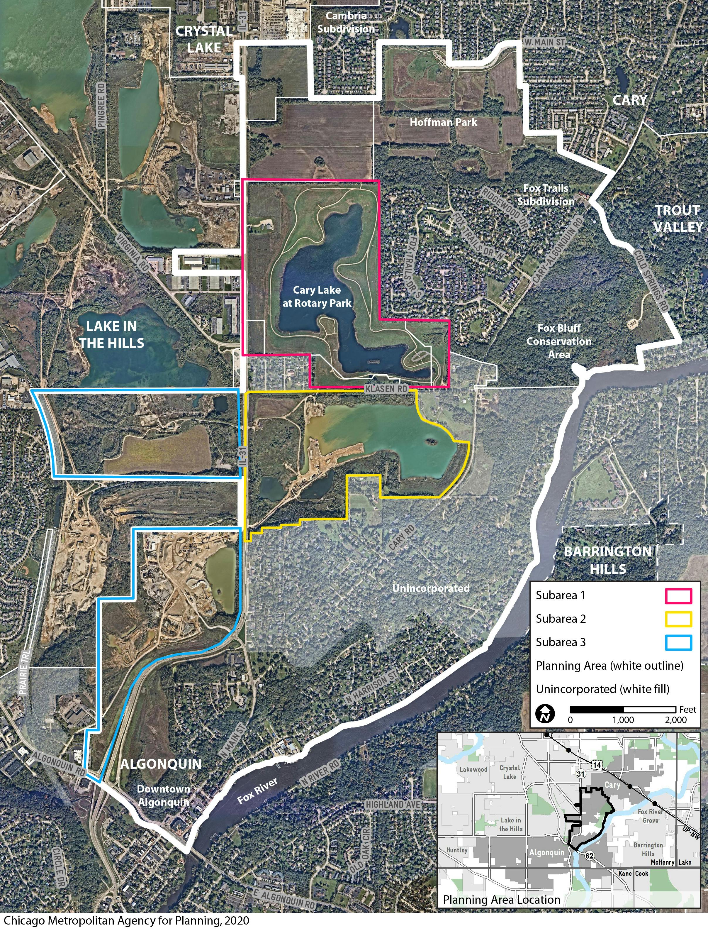
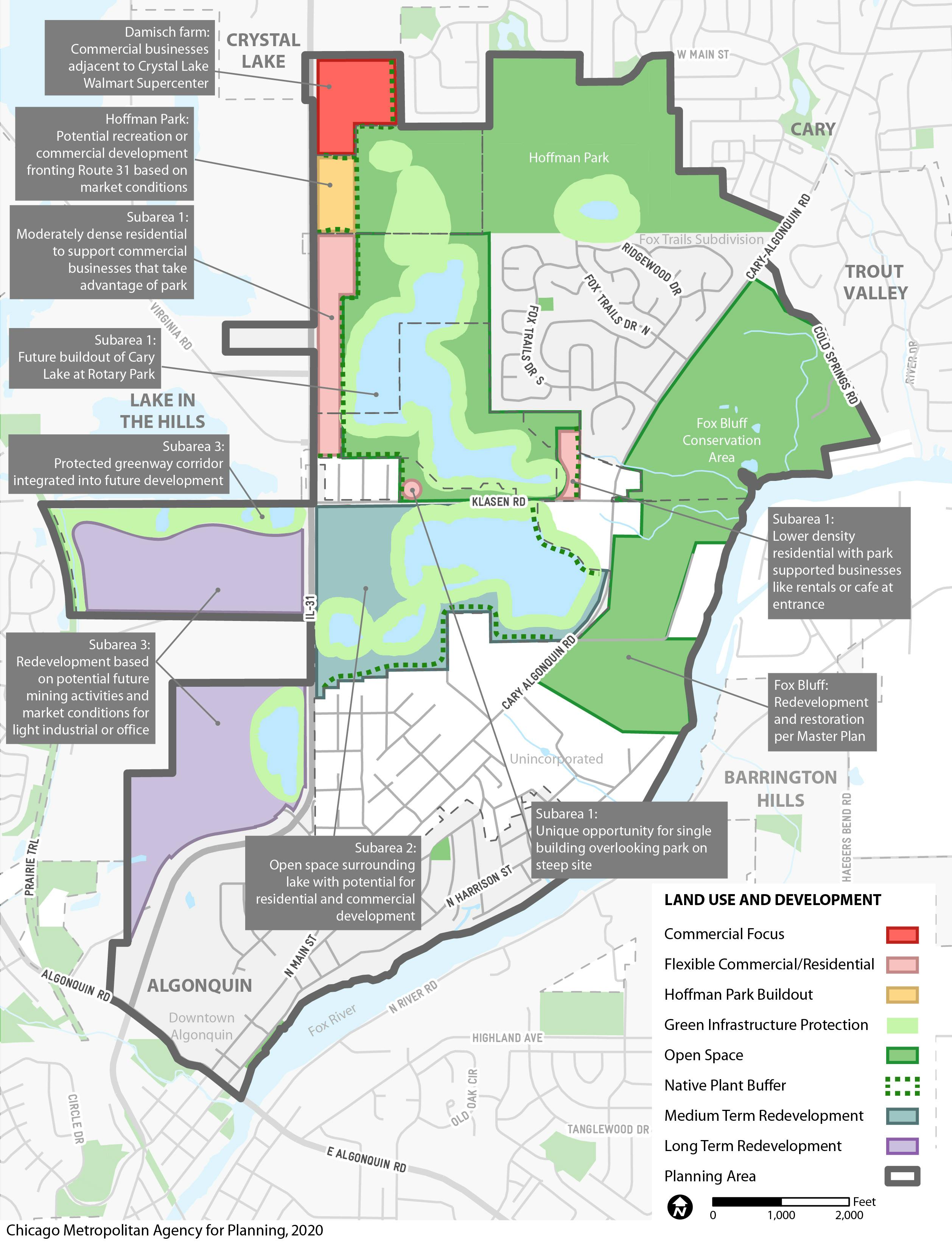
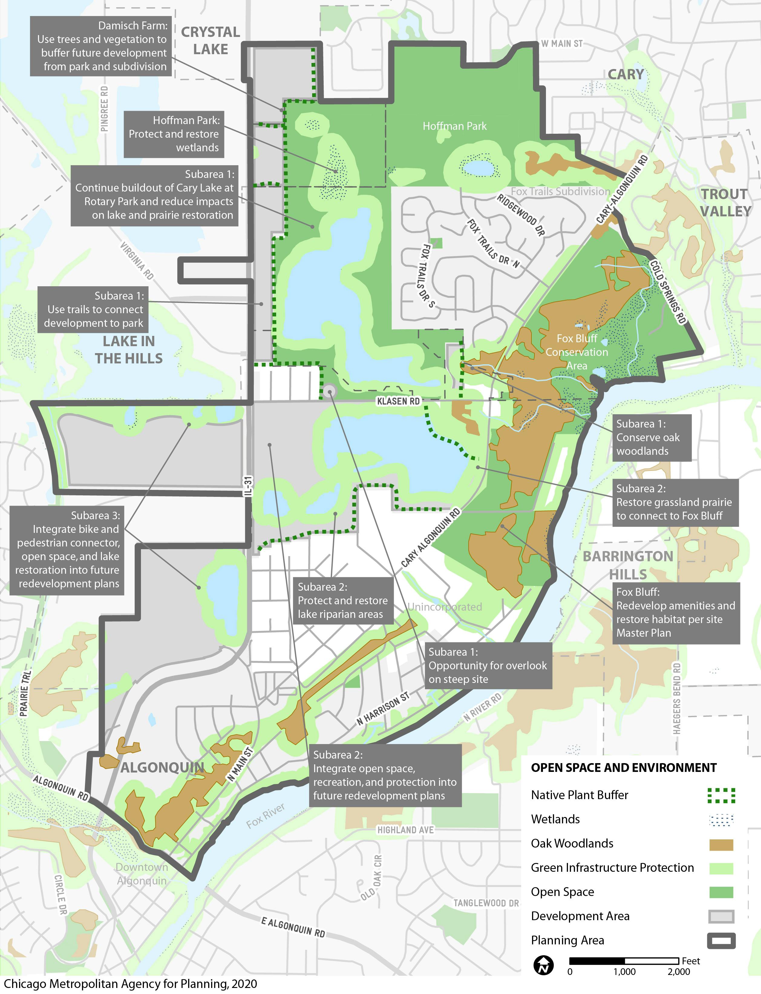
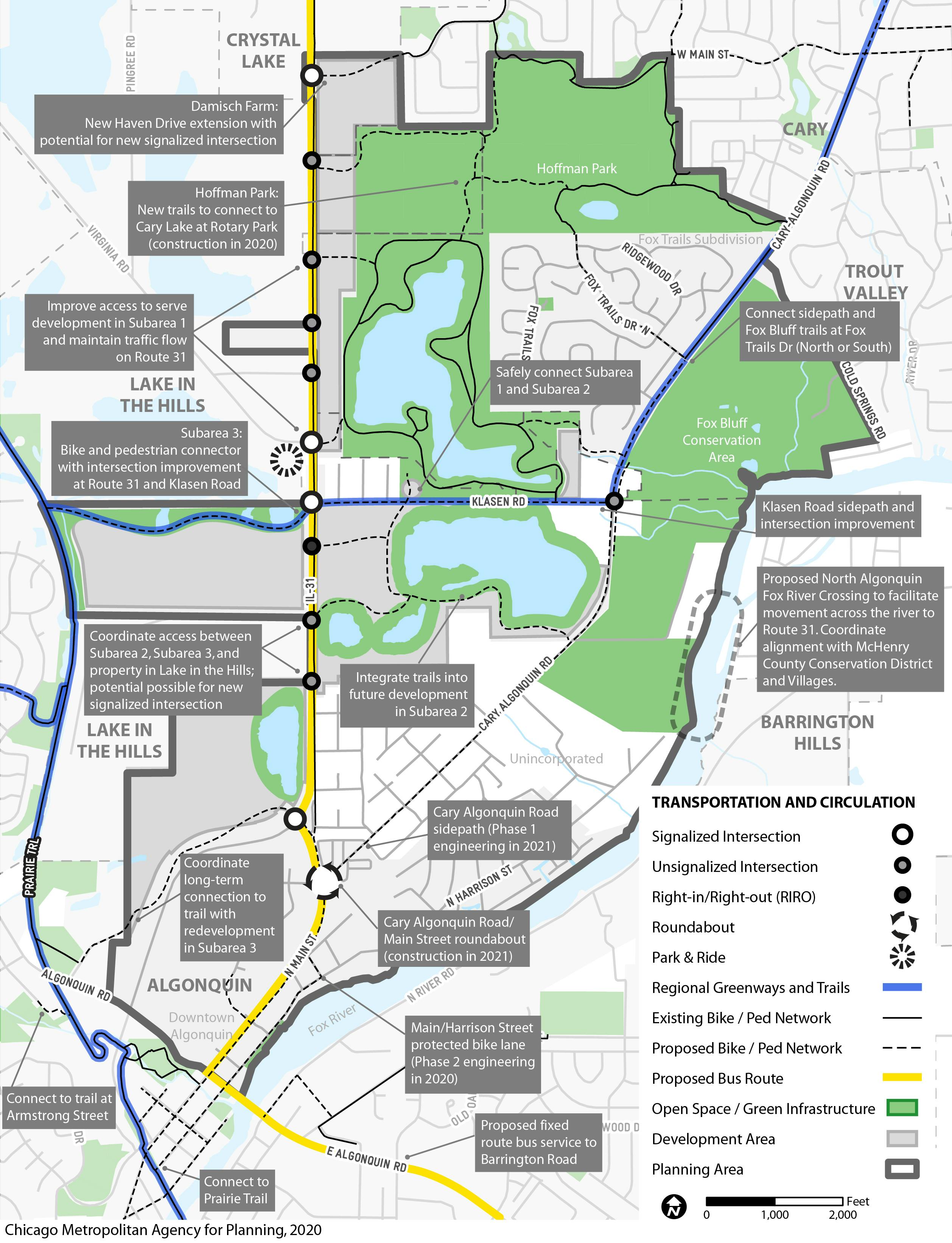
- Subarea 1 - Recommendations for Cary Lake at Rotary Park, Hoffman Park, Damisch Farm, and land along Route 31.
- Subarea 2 - Recommendations for the mining area south of Klasen Road, Fox Bluff Conservation Area, & Cary-Algonquin Road.
- Subarea 3 and Transportation Improvements - Recommendations for the mining areas west of Route 31 and transportation throughout the planning area.
You can also review the project timeline, photos, and FAQs on the right-hand side of this page, and explore the full draft plan here (link).
We invite you to watch the videos, read about the plan, and provide feedback in the discussion forums below. Your responses are a valuable part of the planning process. Please contact Kate Evasic (kevasic@cmap.illinois.gov) with any questions.
Document Library

Who's Listening
-
Phone 847-658-2700 x3300 Email RussellFarnum@algonquin.org -
Phone 847-474-8073 Email bsimmons@caryillinois.com -
Phone 312-386-8782 Email kevasic@cmap.illinois.gov