Regional Freight System Assessment
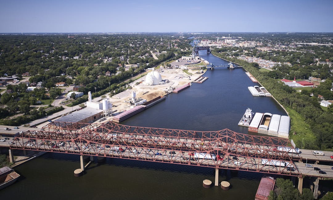
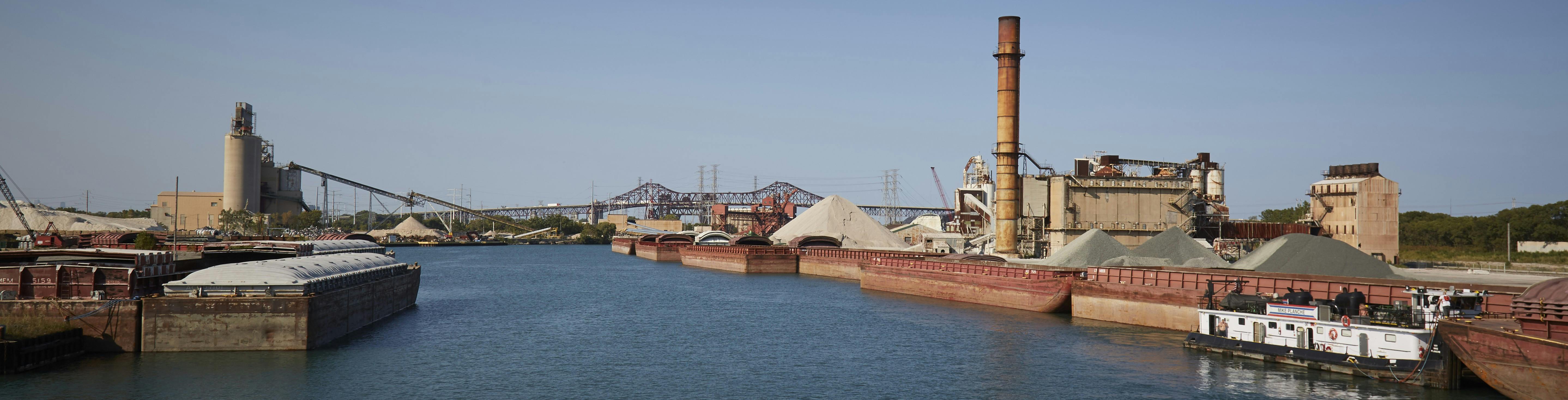
New: As part of its Freight System Assessment, the Chicago Metropolitan Agency for Planning (CMAP) has released a draft report on the region's maritime network and its performance for review and comment. The efficiency, condition, and community impacts of the maritime network are discussed with supporting maps, tables, and graphics. Comments on this draft are welcome (see the news feed at the bottom of this page). Please submit comments by March 23, 2026.
Read The Maritime Network and Its Performance (draft for review)
In 2025, The Chicago Metropolitan Agency for Planning (CMAP) released the Freight Assessment’s first report, The Freight Landscape, to provide key introductory facts about the region’s freight system and to explain fundamental freight concepts.
Freight plays a vital role in the region’s economy. In 2023, nearly 700 million tons of goods were moved to, from, or within the region. These goods were worth more than $1 trillion. The freight industry employed more than 210,000 of the region’s residents in 2024 at more than 14,000 establishments. The freight industry provides the region’s 8.5 million residents access to the goods they need and want, connecting the region’s many businesses to national and international markets.
Read The Freight Landscape.
The Regional Freight System Assessment reviews planning issues for the multimodal freight network in northeastern Illinois, including infrastructure, public policy, and investment programs. The Chicago Metropolitan Agency for Planning (CMAP) is conducting this work as part of its ongoing research and analysis in the development of the 2026 Regional Transportation Plan as well as the Century Plan.
This work includes four deliverables:
- Phase 1, now complete, establishes the freight landscape, defining key terms and concepts, as well as introducing goods movement as a key planning topic for the region.
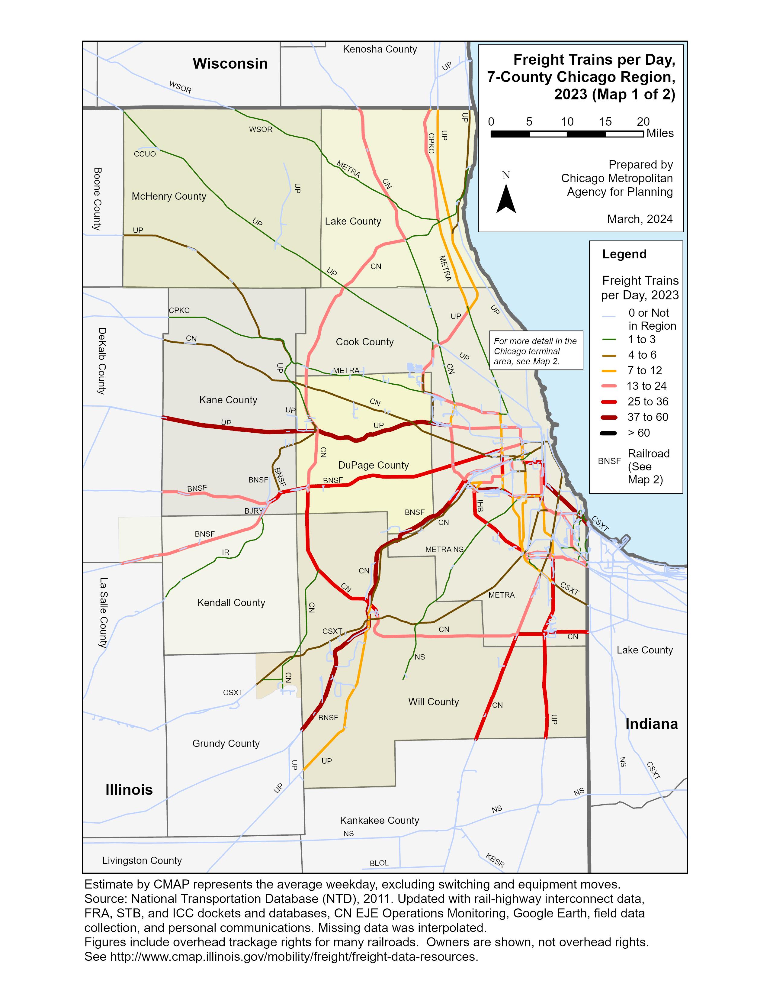
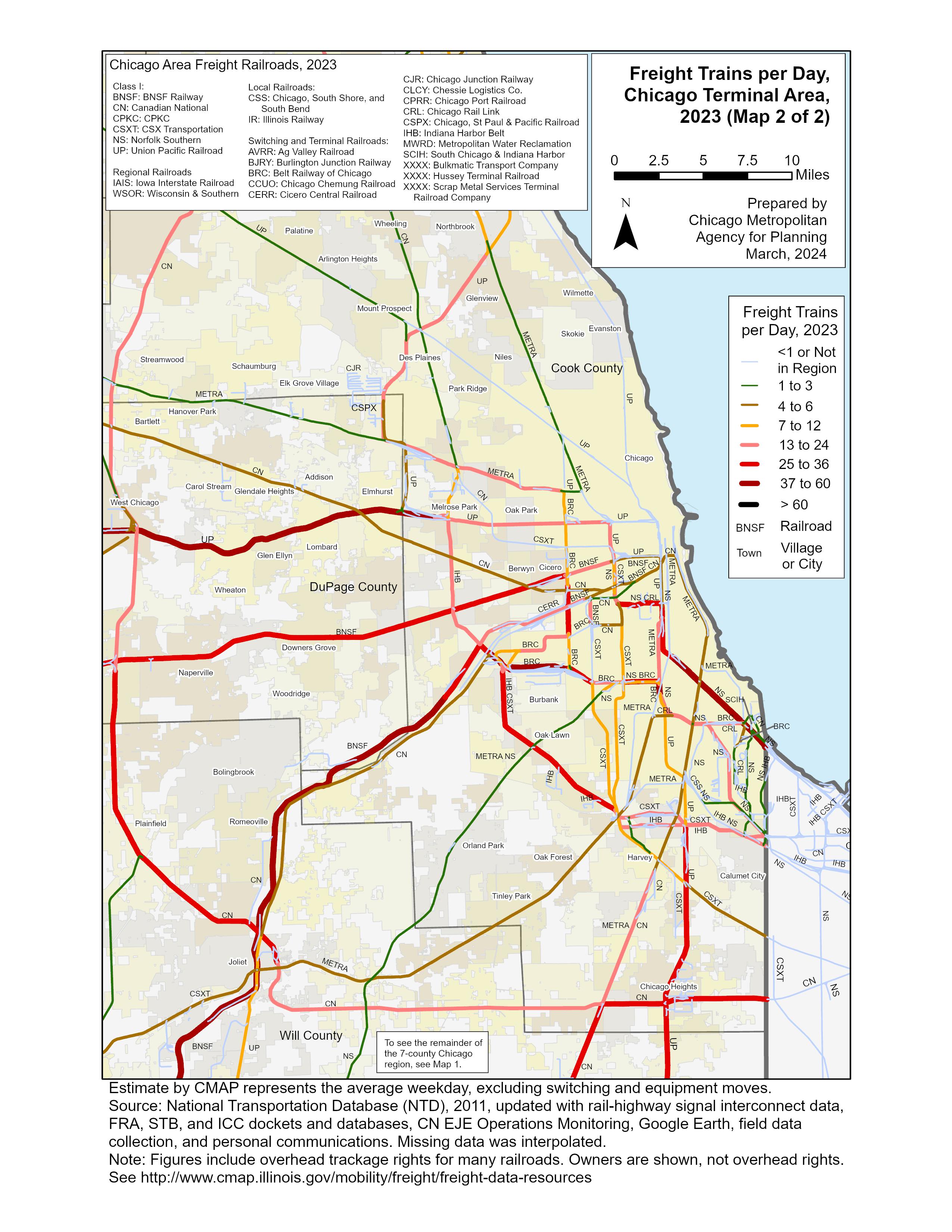
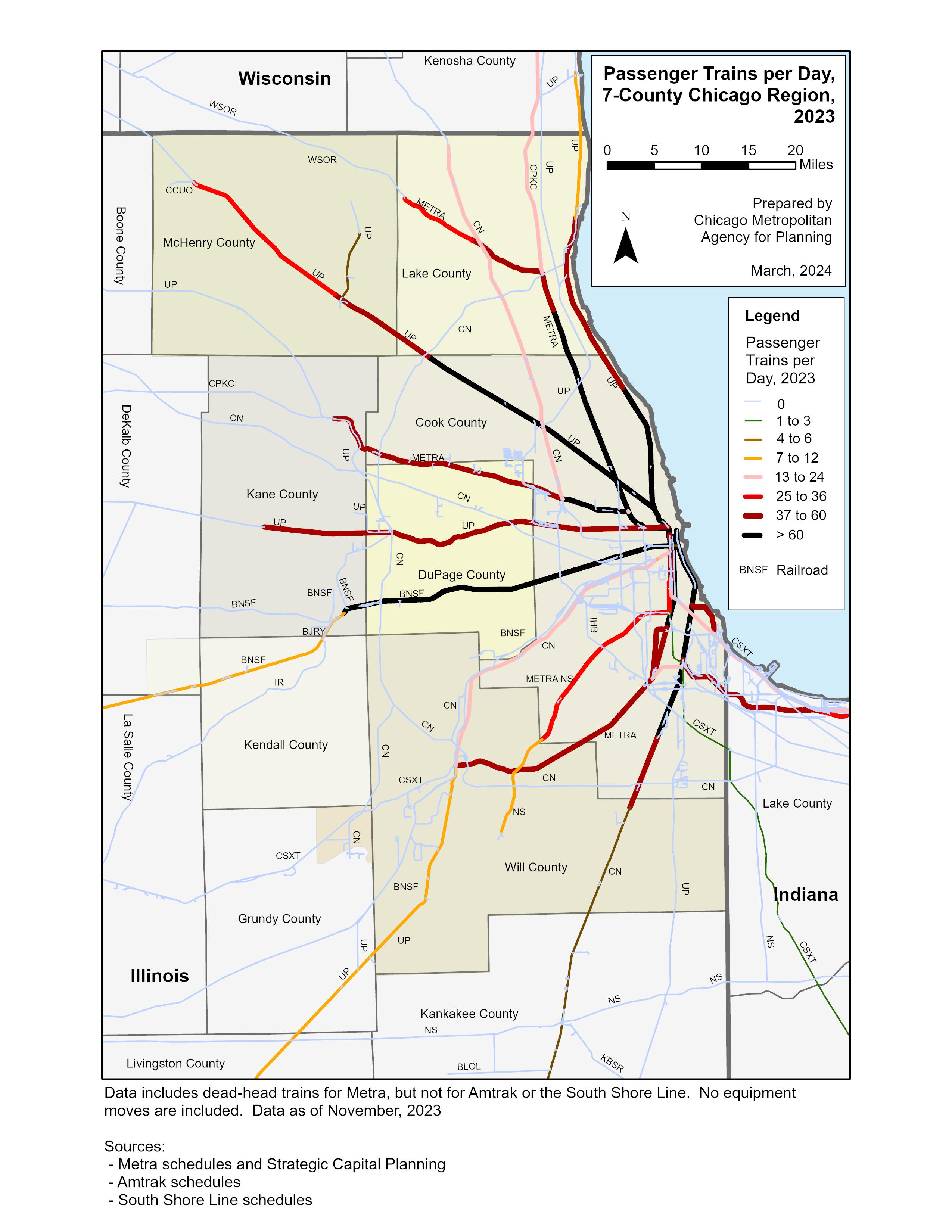
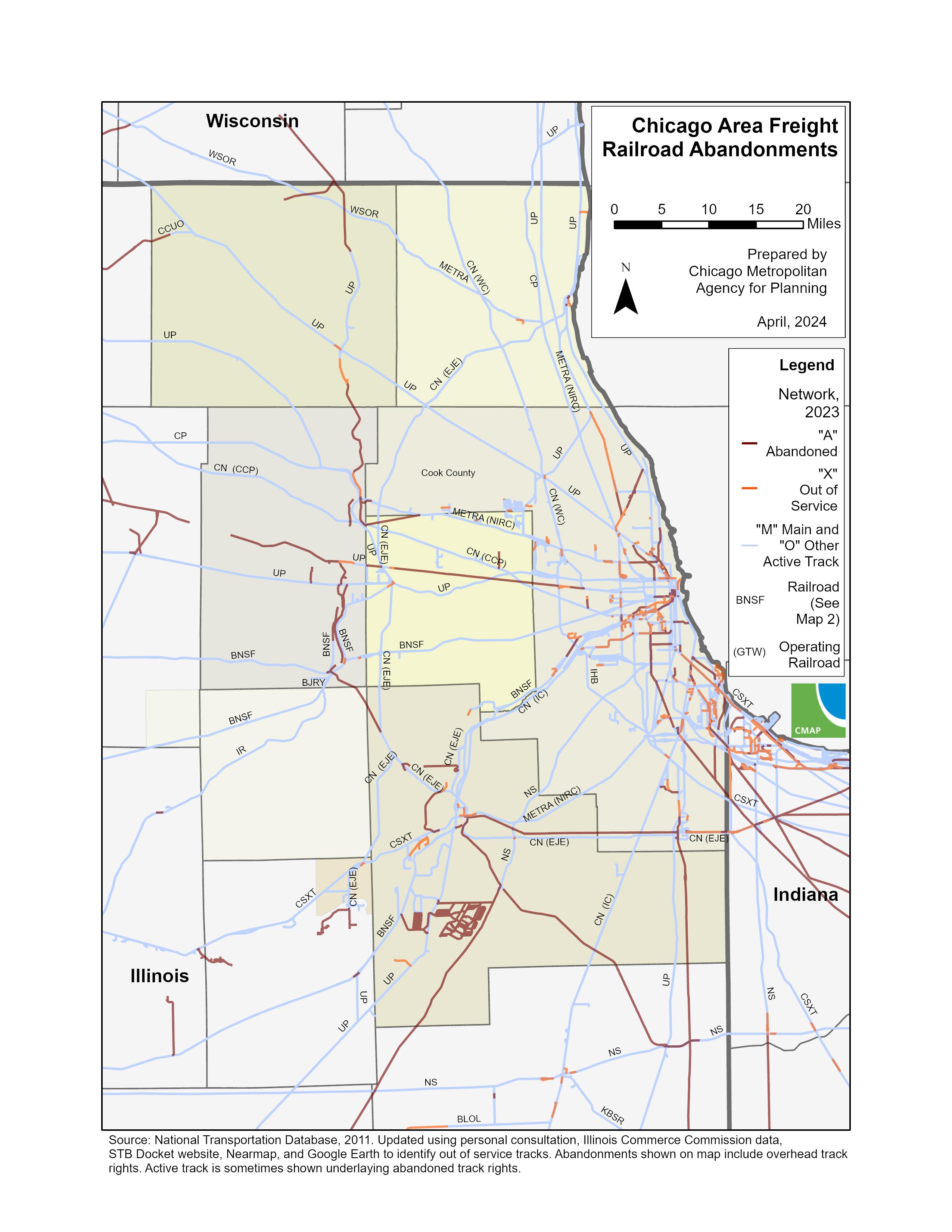
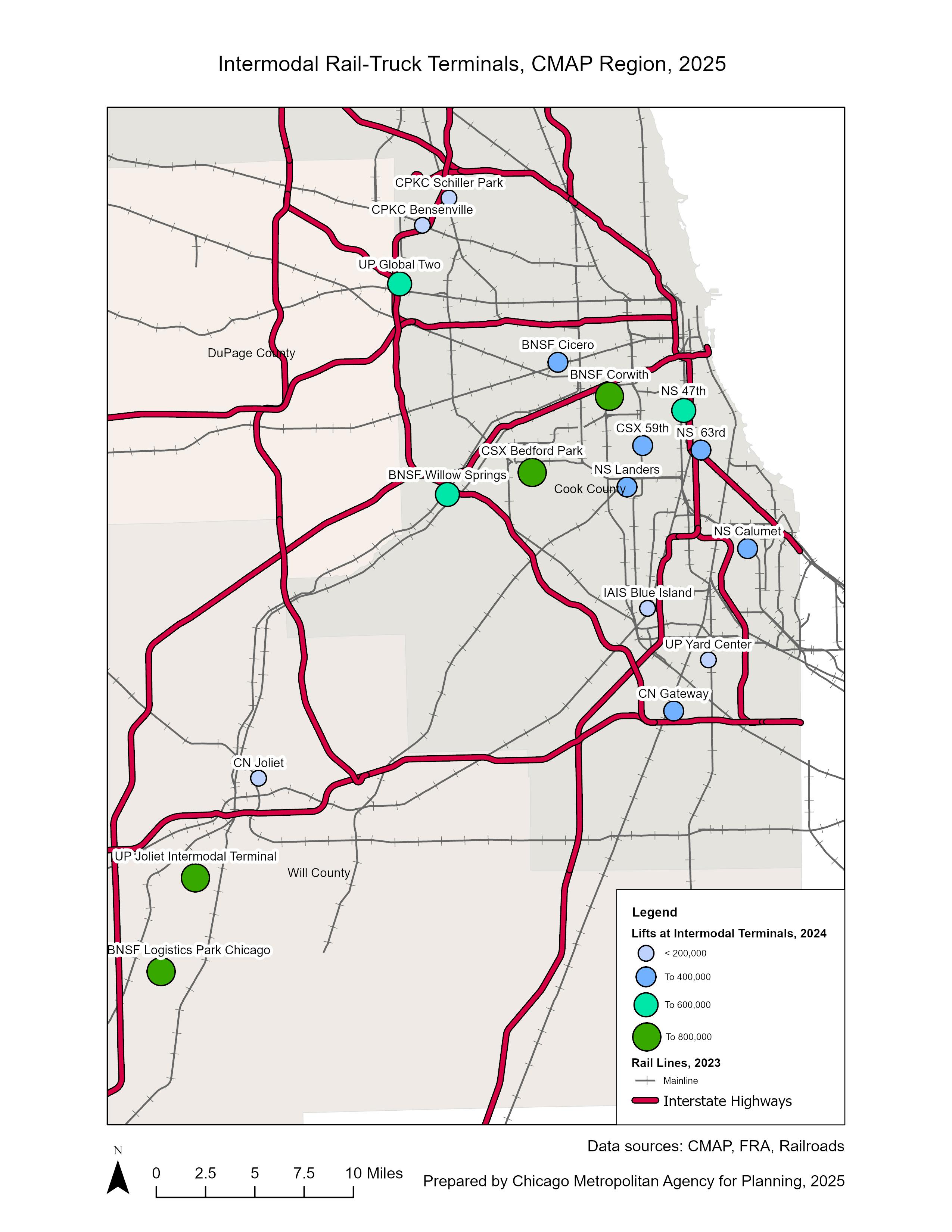
- Phase 2 defines freight networks, assesses their performance, providing maps and other technical reference materials.
- Phase 3 identifies both capital investment and public policy opportunities to support the regional freight system.
- Phase 4 provides final recommendations synthesizing the findings.
-
The maritime network and its performance: draft for review
Share The maritime network and its performance: draft for review on Facebook Share The maritime network and its performance: draft for review on X (formerly Twitter) Share The maritime network and its performance: draft for review on Linkedin Email The maritime network and its performance: draft for review linkComment on our draft report: The Maritime Network and Its Performance. As part of its Freight System Assessment, the Chicago Metropolitan Agency for Planning (CMAP) has released a draft report on the region's maritime network and its performance for review and comment. The efficiency, condition, and community impacts of the maritime network are discussed with supporting maps, tables, and graphics. Comments on this draft are welcome. Please submit comments by March 23, 2026. Comments may be submitted on the form below (registration required) or sent via email to the project leader, Tom Murtha, at tmurtha@cmap.illinois.gov.


Who's listening
-

Phone 312-386-8649 Email tmurtha@cmap.illinois.gov